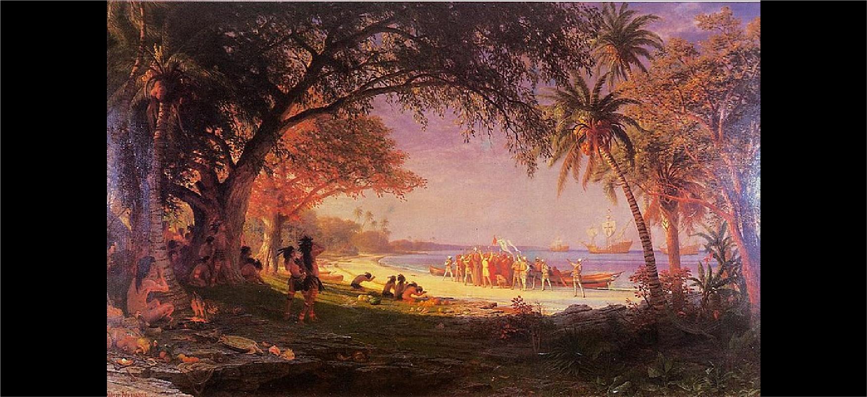
FIGURE 2.1 Columbus Making Landfall. This image of Christopher Columbus making landfall in the New World was painted by the German American artist Albert Bierstadt at the end of the nineteenth century. Ten feet long and six feet high, it presents Columbus in a romanticized fashion, with the Indigenous people bowing before him. They would likely have portrayed the event quite differently. (credit: modification of work “The Landing of Columbus” by Albert Bierstadt/City of Plainfield, New Jersey/Wikimedia Commons, Public Domain)
The sixteenth century was a time of momentous change in Europe. The Age of Exploration began in the late 1400s with forays into the Atlantic by two European nations—Portugal and Spain. Although these countries took the lead and Christopher Columbus has been glorified as a central figure in the history of that exploration (Figure 2.1), they were soon joined by other European players including England, France, the Netherlands, and Denmark. Their extensive overseas exploration and the exploding web of connections in the Atlantic World—the Columbian Exchange, the colonization of the Americas, and the development of the Atlantic slave trade—forever changed people’s understanding of what the world was like and the face and direction of history. Yet far more was altered in the sixteenth century than the human conception of the earth; profound changes in European religious belief also transformed the way many Christians thought of the life they hoped for beyond this one.
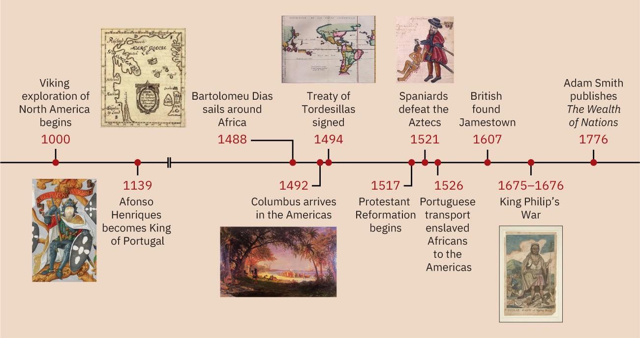
FIGURE 2.2 Timeline: Foundations of the Atlantic World. (credit “1000”: modification of work “Skálholt-map” by Sigurd Stefánsson/Wikimedia Commons, Public Domain; credit “1139”: modification of work “King Afonso Henriques, first King of Portugal, in a 16th century miniature” in The Portuguese Genealogy (Genealogia dos Reis de Portugal)/British Library/Wikimedia Commons, Public Domain; credit “1492”: modification of work “The Landing of Columbus” by Albert Bierstadt/City of Plainfield, New Jersey/Wikimedia Commons, Public Domain; credit “1494”: modification of work “Map of Meridian Line set under the Treaty of Tordesillas” by Library of Congress/Wikimedia Commons, Public Domain; credit “1521”: modification of work “An indigenous Mexican complaint against an abusive encomendero” by Codex Kingsborough/Wikimedia Commons, Public Domain; credit “1675–1676”: modification of work “Philip King of Mount Hope by Paul Revere” by Yale University Art Gallery/Wikimedia Commons, Public Domain)
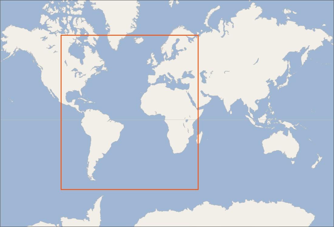
FIGURE 2.3 Locator Map: Foundations of the Atlantic World. (credit: modification of work “World map blank shorelines” by Maciej Jaros/Wikimedia Commons, Public Domain)