Learning Objectives
- Outline how Pakistan and Bangladesh are similar in their populations and economic dynamics but different in their physical environments.
- Understand why the two countries were once under the same government and separated in 1972, when East Pakistan became Bangladesh.
- Describe the various regions of Pakistan and their physical and cultural landscapes.
- Comprehend the impact that large populations have on the natural environment and outline the main environmental issues that confront these two countries.
Pakistan and Bangladesh are two separate and independent Muslim countries physically divided by India. Historically, this was not always the case. From 1947 to 1971, they were administered under the same government as a single political unit for a brief period, and then as eastern and western provinces of Pakistan. The two countries have similarities and dissimilarities. They both have Muslim majorities, and both have high population densities. The countries are two of the top ten most populous countries in the world. Their populations are youthful and mainly rural; agriculture is the main economic activity in each country. Rural-to-urban shift is a major trend affecting urban development. These similar factors indicate that both Pakistan and Bangladesh will face comparable challenges in providing for their large populations and protecting their natural environments. People of Pakistan are different from the people of Bangladesh in terms of culture, language, and ethnic makeup. People in Pakistan speak Urdu language, which is derived mostly from Arabic and Persian language and is based on Arabic script. The Bangladesh population speaks an Indo-Aryan language of Sanskrit origin that is completely different from the Urdu language both in spoken and written forms.
Pakistan (East and West) became independent of British colonial rule in 1947. The country adopted its constitution in 1956 and became an Islamic republic. Many unresolved political, linguistic, and economic tensions between the two wings of the country ultimately resulted in succession of East Pakistan in the form of sovereign country of Bangladesh in 1972. Factors that contributed to the separation of East Pakistan from West Pakistan are complex. Some scholars think that political, cultural, and economic tensions notwithstanding, the union of East Pakistan and West Pakistan was destined for failure from the beginning. Perhaps, the founding fathers foresaw it but agreed to such less than ideal distribution of land in the absence of any other viable options. It should also be noted that the decision to leave India by Britain was made in a hurry. The boundary commission headed by Sir Cyril Radcliffe, had only a few months to decide who would get what, how much, and where. Naturally, under such circumstances, the partitioning of the Indian subcontinent was fraught with problems and thus resulted in one of the most devastating and consequential land distributions and large-scale movements of people across international borders in human history.
A political party known as the Muslim League headed by an elite urbane lawyer, Muhammad Ali Jinah, was responsible for the formation of Pakistan, a predominantly Muslim state for all South Asian Muslims. The Two-Nation theory provided the framework for Muslim’s’ struggle for a separate homeland. The Muslim political leadership realized that 200 years of western colonial rule hads altered the communal harmony in India that existed before the colonization, which had made Hindu-Muslim peaceful coexistence possible. Furthermore, there was also fear that before colonial rule, Muslims were the ruler, whereas in future independent India, they will be a small minority and probably will not have any political power.
Pakistan was created from the former Indian territories of Sindh (Sind), North West Frontier Provinces, West Punjab, Balochistan, and East Bengal. Pakistan was formed with two separate physical regions, defined by religious predominance. East Bengal, on the eastern side of India, was known as East Pakistan, while the remainder, separated by more than one thousand miles, was known as West Pakistan. The two physical units were united politically.
Pakistan (Islamic Republic of Pakistan)
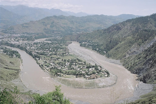
The physical area of Pakistan is equivalent to the US states of Texas and Louisiana combined. Much of Pakistan’s land area comprises either deserts or mountains. The high Himalayan ranges border Pakistan to the north. The lack of rainfall in the western part of the country restricts agricultural production to the mountain valleys and near the river basins. The Indus River flows roughly northeast when traversing the Himalayan and Karakoram Mountains, then southwest along the eastern side of Pakistan forming the Indus plain before flowing into the Arabian Sea. On the Indus Plain, fluvial sediments are deposited in large areas found between river channels and oxbow lakes formed from the constantly changing river channels. These “lands between the rivers” are called “doabs” and represent some of the most fertile land in the Indian subcontinent. The Indus River flows from the northern part of the Karakoram mountains and creates a large, fertile floodplain that comprises much of eastern Pakistan. Pakistan has traditionally been a land of farming. The Indus River Valley and the Punjab are the dominant core areas where most of the people live and where population densities are remarkably high
Figure 9.16

The two core areas of Pakistan are the Punjab and the Indus River Valley.
CIA World Factbook – public domain.
Approximately 64 percent of the population lives in rural areas and in agricultural landscapes. Despite the rural nature of the population, the average family size has decreased from seven to four in recent decades. Nevertheless, the population has exploded from about 34 million in 1951 to more than 227 million according to the 2020 census. About half of the population is under the age of twenty; 35 percent is under the age of fifteen. An absence of family planning has created an ever-increasing population, which is likely to have dire consequences for the economic future of Pakistan. Service and infrastructure catering to the needs of this youthful population are not available to the necessary degree. Schools and educational opportunities for children particularly in rural areas are not adequately funded. As of 2010, only about 50 percent of Pakistan’s population was literate.
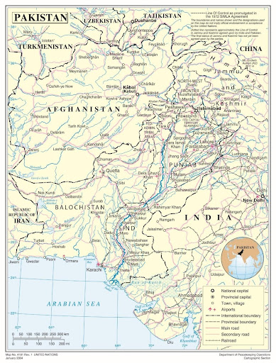
Figure 9.17 Political Map of Pakistan
Karachi, a port city located on the Arabian Sea, was the capital city of Pakistan at the time of independence. In early 1960s, Field Marshal Muhammad Ayyub, the first president of Pakistan, decided to build a new capital city in the foothills of the Himalayas in the vicinity of the garrison city of Rawalpindi, and ancient city of Taxila. The President himself was from the same area. There were also several strategic reasons for relocating the capital to the north, including a need to establish a presence near Kashmir, strategically more secured location, proximity to Pakistan’s most important defense industrial complex, and moderate climate and scenic beauty of the Himalayan Mountains. The groundbreaking of the capital city took place around mid-1960. This example of a forward capital was an expression of geopolitical assertiveness by Pakistan against India.
The lingua franca of the country for the business sector and the social elite continues to be English, even though Urdu is considered the national language of Pakistan and is used as a lingua franca in many areas. More than sixty languages are spoken in the country. There are as many ethnic groups in Pakistan as there are languages. The three most prominent ethnic groups are Punjabis, Pashtuns, and Sindhis.
Regions of Pakistan
The three main physical geographic regions of Pakistan are the Indus River Basin, the Baluchistan Plateau, and the northern highlands. These physical regions are generally associated with the country’s main political provinces. The four main provinces include the Punjab, Baluchistan (Balochistan), Sindh (Sind), and Khyber Pakhtunkhwa (North West Frontier). To the north is the disputed region of Kashmir known as the Northern Areas. Each of these regions represents a different aspect of the country. The North West Frontier has a series of Tribal Areas bordering Afghanistan that have been traditionally under their own local control. Agents under Tribal Agencies have attempted to administer some type of structure and responsibility for the areas, with little success.
The Punjab
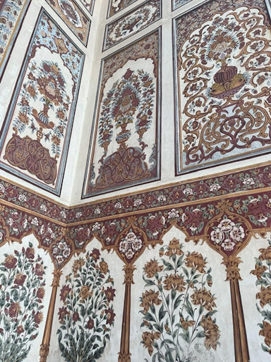
The Punjab is a core area of Pakistan, and has about 60 percent of Pakistan’s population. The five rivers of the Punjab border India and provide the fresh water necessary to grow food to support a large population. Irrigation canals create a water management network that provides water throughout the region. The southern portion of the Punjab includes the arid conditions of the Thar Desert. The northern sector includes the foothills of the mountains and has cooler temperatures in the higher elevations. The Punjab is anchored by the cities of Lahore, Faisalabad, and Multan. Lahore is the cultural center of Pakistan and is home to the University of the Punjab and many magnificent mosques and palaces built during its early history. In the 1980s, many Punjabis migrated to Europe, the Middle East, and North America seeking opportunities and employment. This diaspora of people from the Punjab provided cultural and business ties with Pakistan. For example, trade connections between the Punjab and the United States are increasing. Punjab is the most industrialized of all the provinces. Manufacturing has increased with industries producing everything from vehicles to electrical appliances to textiles. The industrialization of the Punjab is an indication of its skilled work force and the highest literacy rate in Pakistan, at about 80 percent. Lahore is the capital of Punjab province and is the second largest city in Pakistan (largest city is the port city of Karachi). The city served as the summer capital of the Mughal Empire. Many of the buildings constructed by the Mughals in old Delhi (locatedis about 200 miles to east of Lahore, and formerly the seat of Muslim rule in India) and Lahore are quite identical.
Figure 9.18
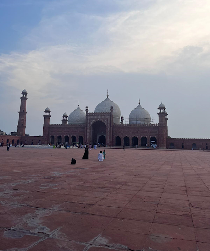
Figure 9.19
Baluchistan
Figure 9.20 Man with His Camel in the Desert Region of Baluchistan in Western Pakistan

Kashif Muhammad Farooq – CAMEL @ GADANI – CC BY 2.0.
Balochistan encompasses a large portion of southwest Pakistan to the west of the Indus River. The region connects the Middle East and Iran with the rest of Asia. The landscape consists of barren terrain, sandy deserts, and rocky surfaces. Balochistan covers about 44 percent of the entire country and is the largest political unit but is very sparsely populated. The sparse population makes a living out of the few mountain valleys where water can be found. Local politics provides the basic structure for society in this region. Within the Baluchistan province of Pakistan are several coastal and interior rivers; the interior rivers flow from the Hindu Kush Mountains of Afghanistan, while most of the rivers along the coastal deserts from west of Karachi to the Iranian border are seasonal in nature and provide one of the few sources of fresh water in those coastal regions. Much of the coastal region is an arid desert with sand dunes and large volcanic mountainous features.
Balochistan is rich in natural resources. The province possesses many minerals including coal, sulfur, chromite, iron ore, barytes, marble, quartzite, and limestone. It has the largest reserves of copper and gold in the world. Balochistan also has huge oil and gas reserves. Sui natural gas fields provide natural gas to the whole country. Balochistan has strategically an important location. Gwadar port, located at the coastal belt of Balochistan, is a deep-sea port in the Indian Ocean, and is strategically important for regional and international players. Under China-Pakistan Economic Corridor (CPEC) of the Chinese Belt and Road Initiative (BRI), several infrastructure development projects in Balochistan have been completed while some are in progress. The United States has been concerned about the Chinese engagement in Balochistan, and. The US fears that China would use the port to extend its sphere of influence. China is heavily involved in several CPEC projects throughout the count
The Sindh
The Sindh (Sind) region of the southeast is anchored by Karachi, Pakistan’s largest city and major port. The Indus River is the border on the west and the Punjab region lies to the north. To the east of the Sindh is the border with India and the great Thar Desert. The Sindh is a region that misses out on the rains from the summer monsoon and the retreating monsoon season, when the winds sweep in from the north over South Asia. The city of Hyderabad, Pakistan, is located along the Indus River, which is a key food-growing area. Food crops consist of wheat and other small grains, with cotton as a major cash crop that helps support the textile industry of the region.
Hyderabad, Pakistan, is not to be confused with a large city with the same name in India.
Figure 9.21 Female Doctor Examining Patient from a Mobile Medical Clinic in the Sindh Region of Pakistan

DFID – UK Department for International Development – A female doctor with the International Medical Corps – CC BY 2.0.
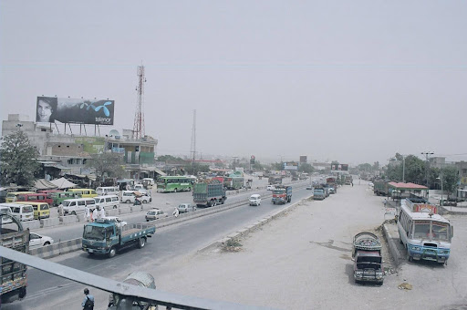
Rural-to-urban shift has pushed large numbers of Sindh residents into the city of Karachi to look for opportunities and employment. In previous sections, slums and shantytowns have been described and explained for cities such as Mexico City and São Paulo; Karachi has similar development patterns. The central business district has a thriving business sector that anchors the southern part of the country. The city has a large port facility on the Arabian Sea. As a city of twelve to fifteen million people or more, there are always problems with a lack of public services, law enforcement, or adequate infrastructure. Urban centers usually have a strong informal economy that provides a means for many of the citizens to get by but is outside the control of the city or national government. The Sindh is the second-most populous region of Pakistan, after the Punjab.
Khyber Pakhtunkhwa (The North West Frontier)
The Northwest Frontier is a broad expanse of territory that extends from the northern edge of Baluchistan to the Northern Areas of Gilgit-Baltistan and the Pakistani controlled part of Kashmir. Sandwiched between the tribal areas along the Afghanistan border and the well-watered lands of the Punjab, the Khyber Pakhtunkhwa province is dominated by remote mountain ranges with fertile valleys and basins. The famous Khyber Pass, a major chokepoint into Afghanistan, is located here. The ancient city of Peshawar, with a population of more than a million people, is the capital of the province (Figure 9.22). Peshawar, once considered the gateway to Central Asia, has a great historical background. It is famous for its handicrafts, museums showcasing Gandhara Civilization’s cultural artifacts, and famous storyteller bazaar.
Figure 9.22
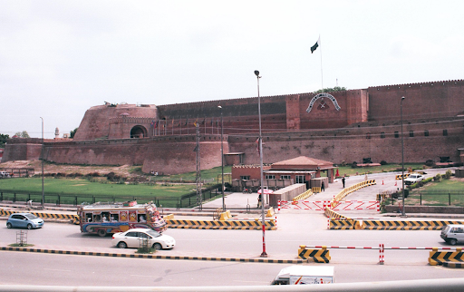
Figure 9.23

The Tribal Areas
The Northwest Frontier borders the Federally Administered Tribal Areas (FATA), where clans and local leaders are standard parts of the sociopolitical structure. These remote areas have seldom been fully controlled by either the colonial governments (the British) or the current government of Pakistan. The semi-autonomous tribal areas consist of seven parts called “agencies”: Bajaur, Mohmand, Khyber, Orakzai, Kurram, and North and South Waziristan. Each tribal ‘agency’ is controlled by the federal government through its ‘Political Agent’, a civil service position. There are also six smaller zones known as frontier regions in the transitional area between the tribal lands and the KPK (Khyber Pakhtunkhwa) province to the east. These frontier regions have been recently merged with the ‘settled areas’ of KPK (i.e., are part of the province). The harsh, mountainous territory of the tribal lands runs along the Afghanistan border. The border between Pakistan and Afghanistan is known as ‘Durand Line’, and was drawn during colonial times by British diplomat Sir Henry Mortimer Durand. It was drawn as a means to divide (between Afghanistan and British India) and weaken the area’s major Pashtun tribes, who were a constant trouble for the British Indian Empire, and also to turn Afghanistan a buffer zone between the British and Russian empires. The Durand Line, which has never been recognized by Afghanistan regardless of who is in power there, is a fluid and porous boundary. The Government of Pakistan has been building fencing and installing monitoring equipment, however, Taliban government in Afghanistan is seriously against these border protection measures, like their predecessors, they too do not recognize the Durand Line as an international border.
Gilgit-Baltistan (GB) and Pakistan Controlled Kashmir
Pakistan’s Northern Areas include the territories that were once part of the Kingdom of Kashmir, the boundaries of which are disputed with India. There are two main political entities: the large northern section bordering Afghanistan and Pakistan’s PKP province is called Gilgit-Baltistan, and the narrow section near Islamabad is called Azad Kashmir (Azad Jammu and Kashmir). The Northern Areas are highlands, bordered to the north by the towering Karakoram and Pamir Mountain ranges. K2, the world’s second highest mountain, which reaches 28,250 feet, is located here. The Northern Areas are sparsely populated, and settlements are present in the valleys where glacial soil and glacial melt water to irrigate summer crops are available. Summer is the only growing season in this area and it is common to grow multiple crops. Crops such as wheat, barley and potatoes are some of the commonly grown crops. The region also produces a variety of fruits such as apricots, apples, and plums. Surplus fruits such as apricot are often dried and preserved for the long winter season to be used as a sugar substitute (Figure. 9.24). Gilgit is the major city and the capital of the Gilgit-Baltistan region. Hunza Valley, a former independent princely state, is the most famous tourist area. The Karakoram Highway, built in the 1960s with the help of China, connects the people of Northern Areas with the rest of the country and also with the Southern Xinjiang region of China through the 17000 ft high Khunjarab Pass.
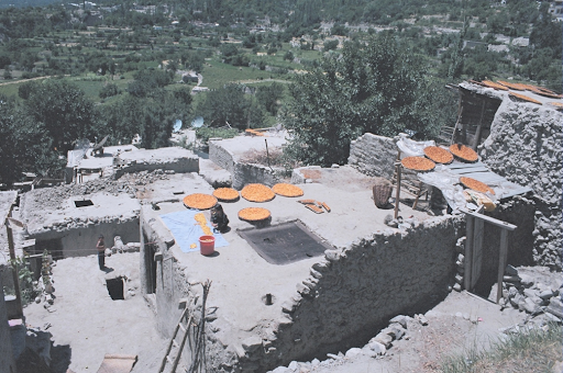
Figure 9.25

Religion and Politics in Pakistan
Today most of the people living in Pakistan are Muslim. About 96 percent of the population in Pakistan is Muslim. The remaining about 4 percent are Hindus, Christians, and other religions. Islam is considered the state religion of Pakistan. The state is a federal republic with a parliamentarian style of government. As an Islamic state following the Sharia laws of the Koran, it has been a challenge for Pakistan to try to balance instituting democratic reforms while staying true to fundamental Islamic teachings. Pakistan has held elections for government leaders, and the status of women has improved. Women have held many governmental and political positions, including serving as prime minister, and judges of the superior judiciary. The current supreme court of Pakistan has two justices who are women. The military has been a foundation of power for those in charge. As a result of weak economic conditions throughout the country, it has been the military that has received primary attention and is the strongest institution within the government. Pakistan has demonstrated its nuclear weapons capability in recent years, which established it as a major player in regional affairs.
Pakistan has suffered from inadequate funding for public schools. As a rule, the wealthy urban elites have been the only families who could afford to send their children to college. Poor families who lack means for sending their Children to college often send them to Islamic religious schools called madrassas, which teach children the Koran, Islamic law, and other disciplines. Much of the funding for religious schools comes from private donations and also from outside sources such as Saudi Arabia. Although madrassas do not provide the skills needed for making a living in the modern world, it has been contributing in improving the general literacy among the adult population. Pakistan has worked to build schools, colleges, and universities to educate its people. The situation is that population growth has been outpacing what little budget is allocated for educational purposes.
The government of Pakistan has struggled to meet the challenge posed by the democratic structure of its constitution. The combination of a federal republic and an Islamic state creates a unique and at times difficult balance in administrative politics. The legislative body of Pakistan consists of a National Assembly and a Senate. The leader of the National Assembly is the prime minister. The elected president (elected by the senate or upper chamber of the house) not only is the commander in Chief of the armed forces but is also head of state. The military establishment and the Inter-Services Intelligence (ISI) agency hold major political power in Pakistan. The political leadership has often vacillated between military and civilian rule.
Benazir Bhutto: The First Female Prime Minister of Pakistan
Women’s roles in Pakistani leadership have been complex. To understand the impact of electing the first woman prime minister in Pakistan, one has to go back to 1972. At that time, East Pakistan gained its independence and changed its name to Bangladesh. At roughly the same time, Pakistan elected President Zulfikar Ali Bhutto to power. After ruling for five years, Zulfikar Ali Bhutto was ousted from power and sentenced to death by General Zia, who became the next president. General Zia was the first military general to also be president. He allowed the Islamic Sharia law to be introduced into the legal system, which bolstered the influence of Islam on the military and government services. In 1988, General Zia was killed in an unexplained plane crash. The daughter of the first president—Zulfikar Ali Bhutto—was then elected as prime minister. The thirty-five-year-old Benazir Bhutto was the first female prime minister of Pakistan.
Benazir Bhutto’s tenure as prime minister was short-lived. After a year and a half, the president removed her from office on accusations of corruption. She ran again in 1993 and was reelected to the prime minister position. Charges of corruption continued and she was removed as prime minister a second time in 1996. Political corruption, or the accusations of such a charge, is not uncommon in Pakistan or other countries with volatile political situations. To keep from being prosecuted by her opposition, Benazir Bhutto left Pakistan in 1998 and lived in Dubai. She did not return to Pakistan until 2007, under an agreement reached with the military general who was president at the time, General Pervez Musharraf. Benazir Bhutto was given amnesty for any and all claims against her.
Figure 9.26

Benazir Bhutto visits the United States in 1989 while she was the prime minister of Pakistan.
Wikimedia Commons – public domain.
The elimination of the corruption charges against her allowed Benazir Bhutto to become a candidate for the office of president. She organized an effective campaign. Her campaign for the presidency energized the political landscape of the country. In December of 2007, her campaign was cut short. Benazir Bhutto was assassinated after departing a political rally. She was assassinated a few weeks before the polls were to open for the election. Benazir Bhutto was the leading opposition candidate. Her death rallied support against General Musharraf with continued calls for his removal from office. General Musharraf resigned from the presidency in 2008. The winner of the presidential elections that followed was none other than Benazir Bhutto’s husband, Asif Ali Zardari. President Zardari blamed the Taliban for the assassination of his wife.
Environmental Issues in Pakistan
Pakistan is confronted with a range of natural disasters and environmental issues including frequent flooding in low lying areas, frequent earthquakes in northern areas, and air and water pollution. Northern areas of Pakistan including the federal capital city of Islamabad, all lie in close proximity to the most tectonically active region of the western Himalayas. This is where the Eurasian and Indian tectonic plates are at the colliding path and the major fault and thrust complexes, such as MBT (Main Boundary Thrust) Fault are present (Figure 9.26). Shifting and colliding of tectonic plates are the cause of frequent earthquakes in the area. There have been several major earthquakes in Pakistan’s recent history. For instance, an earthquake of 7.6 magnitude in 2005 in the northern region of PKP and Pakistani-control Azad Kashmir, and in neighboring India and Afghanistan, claimed thousands of lives and destruction of property and more in neighboring areas. Hardest hit outside of Pakistan was the portion of Kashmir that is controlled by India. Many countries, including the United States, stepped up and supported the aid effort to reach people in the devastated region. Major earthquakes that cause devastation for the large populations here are common along this tectonic plate boundary. In 2010, another earthquake in Hunza Valley of Gilgit Baltistan triggered a landslide which blocked the Hunza River creating a lake. Several villages and farming land along the river were inundated. The lake also blocked a portion of Karakoram Highway, which cut off people of upper Hunza valley from the rest of the country for several months (see Natural Hazards in Northern Areas).

Deforestation is another environmental problem in Pakistan, because the demand for wood for cooking fuel and building is on the rise. Only about 2.5 percent of Pakistan is forested. In the last two decades, Pakistan has lost about one-fourth of its forest cover. The removal of forests causes widespread soil erosion during heavy rains and decreases natural habitat for organisms and wild animals. Efforts to protect the biodiversity of the country have been minimal and are complicated by the increase in population, which is expected to double in about forty-five years if population growth remains on its current trajectory. The reality is that deforestation is likely to continue in Pakistan, with little hope of a solution anytime soon.

Bangladesh
Bangladesh is a low-lying country that is associated with the types of marshy environments found in tropical areas and river deltas. The region is extremely prone to flooding, particularly during the monsoon season because of the high amount of rainfall. One of the most important rivers of Bangladesh flows southward from the Himalayas through India and into Bangladesh. While in India, this river is known as the Brahmaputra River, but when it enters Bangladesh, it is known as the Jamuna River. It provides a major waterway for this region and empties into the Bay of Bengal.
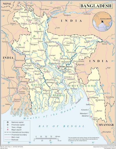
Figure 9.30 Political Map of Bangladesh
Contributing to the immense flow of water through the country are the Ganges and the Meghna rivers, which join up with the Brahmaputra River near the sea. The Ganges flows through northern India and is a major source of fresh water for a large population before it reaches Bangladesh. The Meghna is a collection of tributaries within the boundaries of Bangladesh that flows out of the eastern part of the country. The Meghna is a deep river that can reach depths of almost two thousand feet with an average depth of more than one thousand feet. The hundreds of water channels throughout the relatively flat country provide for transportation routes for boats and ships that move goods and people from place to place. There are few bridges, so land travel is restricted when rainfall is heavy.
Population and Globalization
Bangladesh is about the size of the US state of Wisconsin but is one of the most densely populated countries in the world. According to the 2022 census, the population of Bangladesh is over 171 million, whereas the land area of the country is only 55,556 square miles, which translates to more than 3000 persons living in one square mile area. In comparison, the population density of the U.S. is only 96 persons living in one square mile area. Most of the population in Bangladesh is rural and engaged in agriculture. The rural areas often suffer from a lack of adequate transportation, infrastructure, and public services. Poverty is high in rural areas. Income levels average the equivalent of a few US dollars per day. The larger cities, such as the capital of Dhaka, have modern conveniences and better infrastructure. Like other South Asian countries, Bangladesh also has rural to urban migration problems making cities extremely crowded (Figure. 9.30).
There are many ethnic groups in Bangladesh, and many languages are spoken. The official and most widely used language in Bangladesh is Bengali (Bengal), which is an Indo-Aryan language of Sanskrit origin and has its own script. A Presidential Order in 1987 made Bengali the official language for the government of Bangladesh. Bengali is also the main language for the Indian state of West Bengal, which neighbors Bangladesh. English is used as the lingua franca among the middle and upper classes and in higher education. Many minor languages are spoken in Bangladesh and in the region. Majority of the population, about 90 percent, is Muslim. There is a sizable minority, about 9 percent, which adheres to Hinduism, Buddhism, Christianity, or animism.
Figure 9.31 Street Scene in Dhaka, the Capital of Bangladesh

Ben Sutherland – The streets of Dhaka – CC BY 2.0.
Bangladesh suffers from a demographic dilemma. Its tropical climate, availability of fresh water, and productive agricultural land have augmented a high population growth rate. The ever-increasing population is a growing concern. The government has stepped up its support for women’s health, birth control, and family planning services. This is an Islamic country, but practical approaches and common sense in regard to population control have won out over Islamic fundamentalism, which has not always supported family planning. This poor and highly populated country has experienced political problems. Most of the people work in agriculture, while the remaining population is primarily concentrated in the service sector. Small business enterprises have been encouraged by the issuing of microcredit, or small loans, to assist people in using their skills to earn income.
Globalization is evident in Bangladesh. As a result of the availability of cheap labor, sweat shops have been implemented to manufacture clothing for export to the world markets. The country also receives financial remittances from Bangladeshis working overseas in places such as the oil-rich region of the Middle East, which also is predominantly Muslim and is attracting cheap labor for its economic development projects funded by oil revenues. One example of how Bangladesh has been able to acquire materials such as steel is in the recycling of old ships. Shipping companies that have ships that are no longer viable for modern shipping have brought them to the shores of Bangladesh to be stripped down, taken apart, and the materials recycled.
Environmental Issues
The northeast part of Bangladesh receives the highest amount of rainfall from summer monsoon, averaging about eighteen feet per year, while the western part of the country averages only about four feet per year. Bangladesh can grow abundant food crops of rice and grain in the fertile deltas of the Ganges and Brahmaputra Rivers (Figure. 9.31). About 55 percent of the land area is arable and can be used for farming, but flooding causes serious damage to cropland by eroding soil and washing away seeds or crops. Every year, countless people die because of the flooding, which can cover as much as a third of the country. One of the worst flooding events in Bangladesh’s history was experienced in 1998, when river flooding destroyed more than three hundred thousand homes and caused more than one thousand deaths, rendering more than thirty million people homeless.
Most parts of Bangladesh are fewer than forty feet above sea level, and the country is vulnerable to major flooding according to various global warming scenarios. Half of the country could be flooded with a three-foot rise in sea level. Storm surges from cyclones killed as many as one hundred fifty thousand people in 1991, and the death toll of 300-500 thousand from the Great Bhola Cyclone 1970 is often cited as the world’s largest.. In comparison, about two thousand people died when Hurricane Katrina hit New Orleans in 2006. The high death toll from flooding does not receive its due attention from Western news media. Environmental concerns increase with the long-term projections of climate change. If sea level rises or if storms increase, then the low-lying agricultural lands of Bangladesh would suffer even more flooding and devastation. This would decrease the food supply of a growing population.
Another environmental problem for Bangladesh is deforestation. Wood is traditionally used for cooking and construction. The needs of a larger population have caused widespread deforestation. Brick and cement have become alternative building materials, and cow dung has become a widely used cooking fuel even though it reduces the fertilizer base for agriculture. Even so, these adaptations have not halted the deforestation problem. The main remaining forests are located along the southern borders with India and Burma (Myanmar) and in the northeast of the country
Figure 9.32 Man Working in a Rice Field in Bangladesh

Wikimedia Commons – public domain.
Bangladeshis suffer because of widespread water pollution from naturally occurring arsenic that contaminates water wells. The pyrite bedrock underneath much of western Bangladesh has large amounts of arsenic in it. Millions of people drink groundwater contaminated with this arsenic on a daily basis. Arsenic kills people slowly, by building up in their bodies, rotting their fingernails, giving them dark spots and bleeding sores. Arsenic is a slow killer and a carcinogen that increases the risk of skin cancer and tumors inside the body. Villagers in Bangladesh began being affected by these symptoms in the 1970s. In 1993, official tests indicated that up to 95 percent of the wells in one of the villages in the western region were contaminated. The widespread water contamination has also had a social cost. Reports indicate that husbands are sending their disfigured wives back to their families of origin, and some young people are remaining single. Stories are told of people who believe that the health problems are contagious or genetic and can be passed on to children, which causes dilemmas for women who are trying to find a husband.
Women and Banking in Bangladesh
Despite an overall languishing economy, economic success stories in this poor country do exist. The Grameen Bank has been working to empower women in Bangladesh for many years. The bank issues microcredit to people in the form of small loans. These loans do not require collateral. Loans are often issued to impoverished people based on the concept that many of them have abilities that are underutilized and can be transformed into income-earning activities. About 96 percent of these loans are to women, and the average loan is equivalent to about one hundred dollars. Women have proven to be more responsible than men in repaying loans and utilizing the money to earn wealth. The loan recovery rate in Bangladesh is higher than 98 percent (Grameen Support Group, 2011). Microcredit has energized poor women to use their skills to make and market their products to earn a living. More than five million women have taken out such loans, totaling more than five billion dollars. This program has energized local women to succeed. It has been a model for programs in other developing countries.
Key Takeaways
- When Britain’s colonialism ended in South Asia in 1947, the Muslim League was instrumental in creating the united Muslim state with both East Pakistan and West Pakistan under one government. East Pakistan broke away and became the independent country of Bangladesh in 1972.
- Both Pakistan and Bangladesh have large populations that are increasing rapidly. Both countries have agriculturally based economies. Rural-to-urban shift is occurring at an ever-increasing rate in both countries. Population growth places a heavy tax on natural resources and social services.
- The political units within Pakistan include four main provinces. Tribal Areas border Afghanistan and are controlled by local leaders. The Northern Areas are disputed with India. Each of the provinces has its own unique physical and human landscapes.
- Earthquakes are common in Pakistan because the country is located on a tectonic plate boundary. Deforestation and water pollution are two other major environmental concerns.
- Bangladesh is a low-lying country with the Brahmaputra River, Ganges River, and the Meghna River flowing into the Bay of Bengal. Flooding is a major environmental concern that has devastated the country on a regular basis.
Discussion and Study Questions
- What happened to East Pakistan? Why did its name change?
- Why does Pakistan have a forward capital? Where is it? Where did the capital used to be?
- Compare the population density of Pakistan, Bangladesh, and the United States.
- What are the four main provinces of Pakistan? How are they different from each other?
- How is Bangladesh affected by the summer monsoon? How much rain can it receive annually?
- What are the main environmental problems in Pakistan? In Bangladesh?
- What type of government does Pakistan have? What is the law based on?
- How could both countries address their population growth situation?
- Who was the first woman prime minister of Pakistan? What happened to her?
- How has microcredit aided in the economic development of Bangladesh?
Geography Exercise
Identify the following key places on a map:
- Arabian Sea
- Azad Kashmir
- Baluchistan
- Bay of Bengal
- Brahmaputra River
- Ganges River
- Gilgit-Baltistan
- Hyderabad
- Indus River
- Karachi
- Khyber Pakhtunkhwa
- Khyber Pass
- Lahore
- Meghna River
- Northern Areas
- Punjab
- Sindh
- Thar Desert
- Tribal Areas
References
Grameen Support Group, “Grameen Bank—Banking on the Poor,” accessed November 14, 2011, http://www.gdrc.org/icm/grameen-supportgrp.html.
